Wednesday, August 31, 2022

2022 Mt. Whitney Day 4B: Colby Pass To Junction Meadow


 Distance: 10.96 Miles/17.64 Km

Time: 9.5 hours

Elevation Gain: 1665 ft/507.5 m


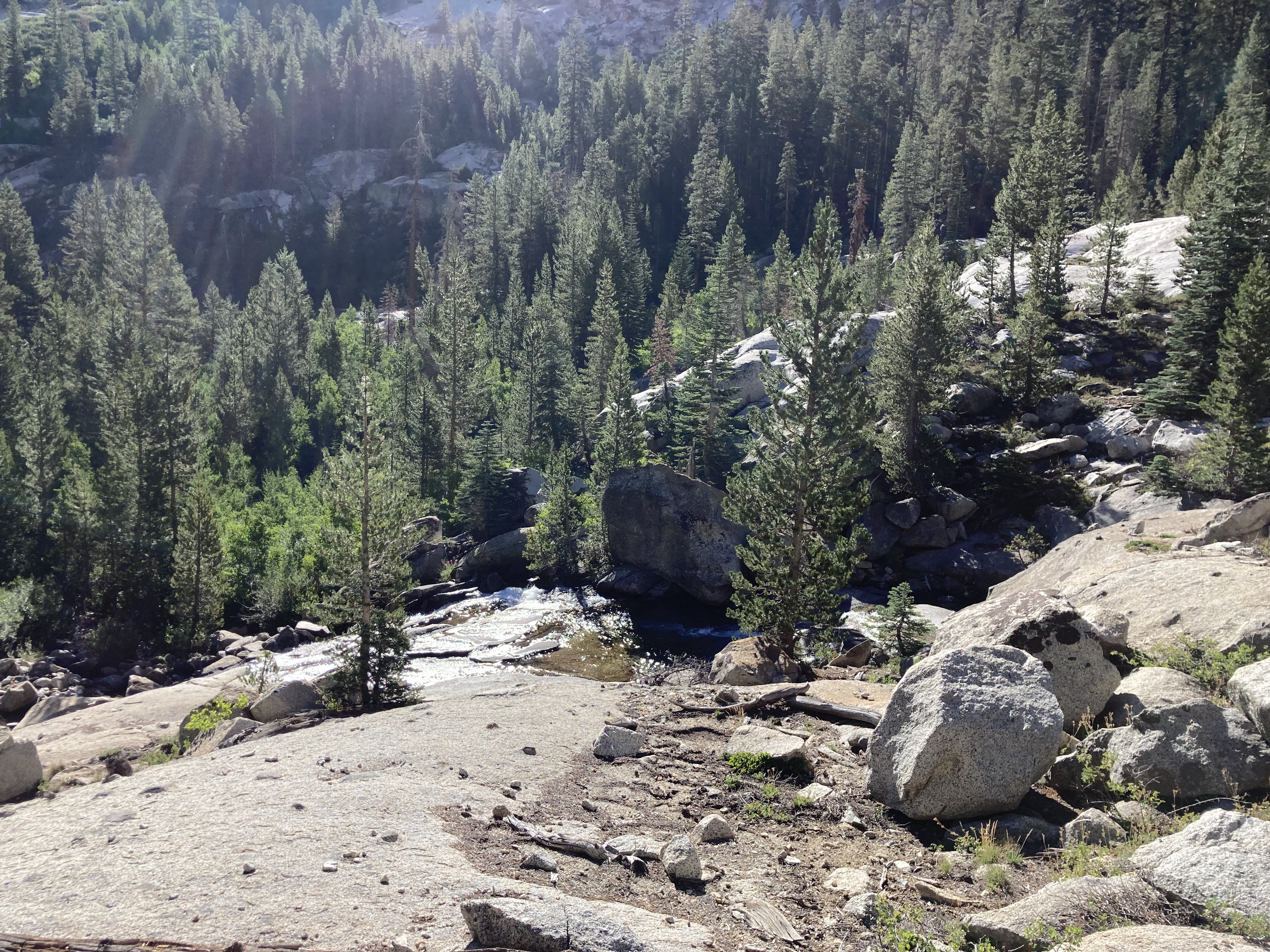
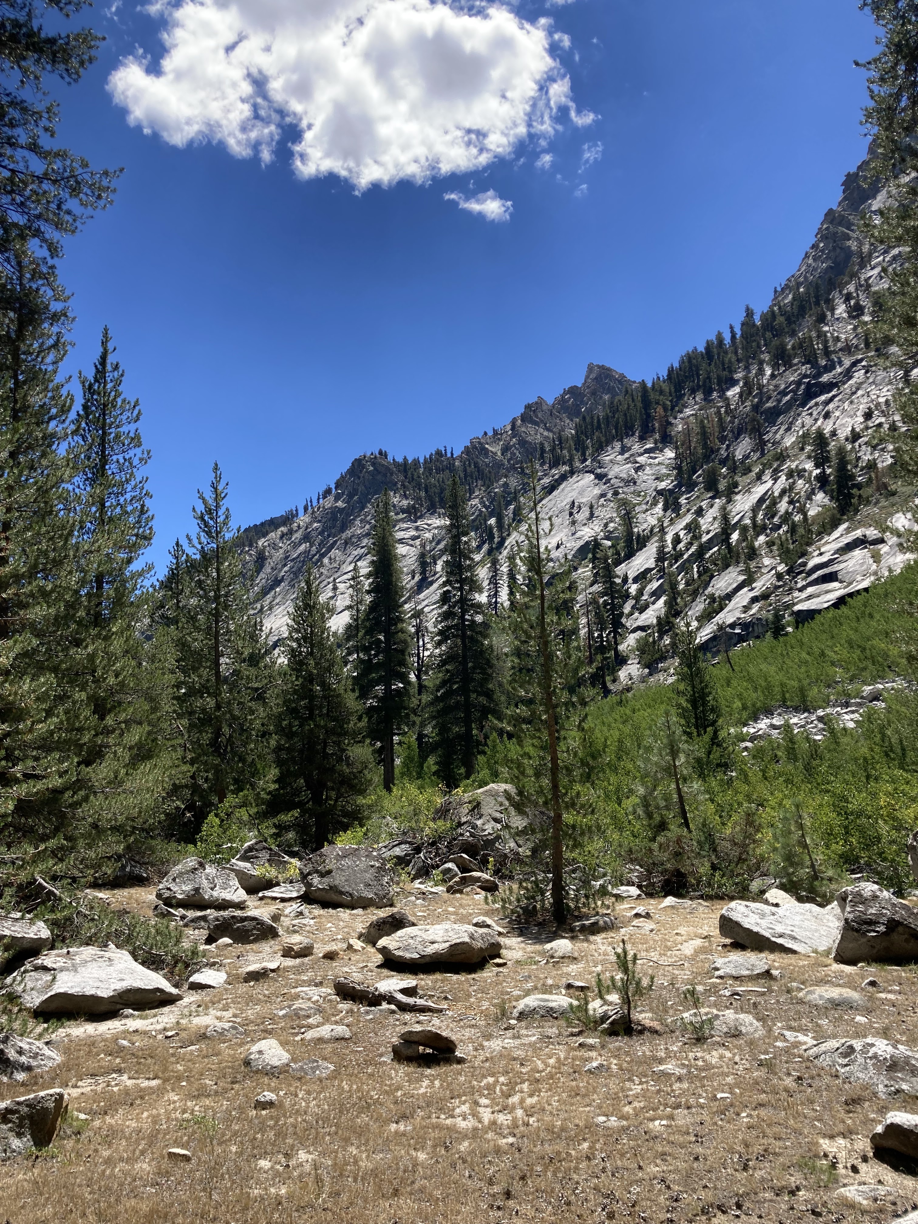
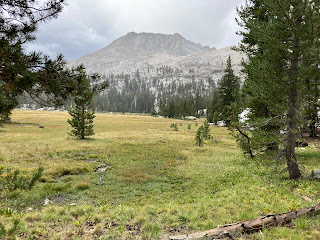
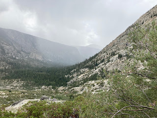
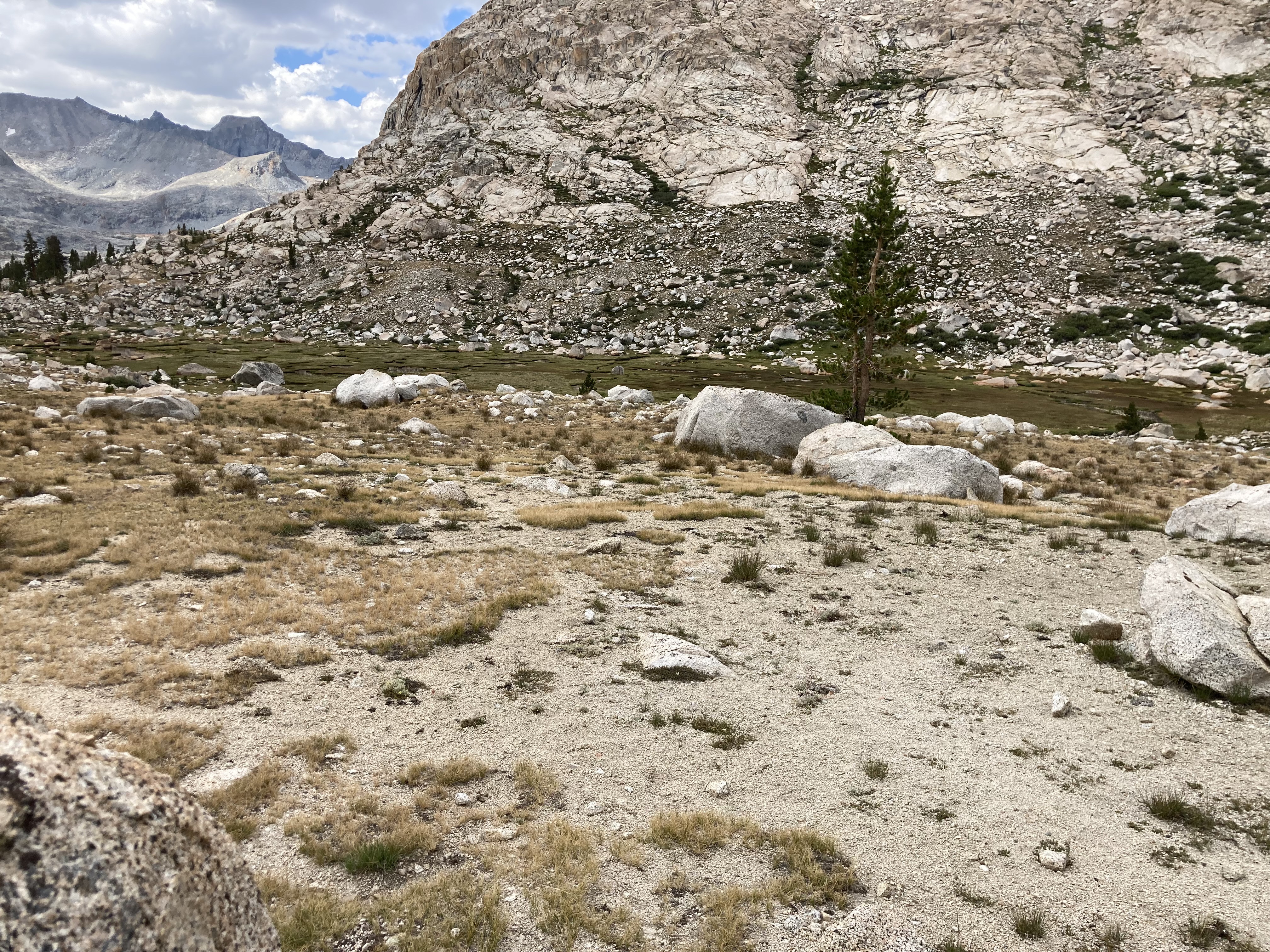
When we last left our heroes, we had just arrived at Colby Pass after some amount of physical effort and sweat.  But one thing one learns in hiking:  what goes up, has to come down.  And so, back down we went.


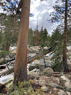
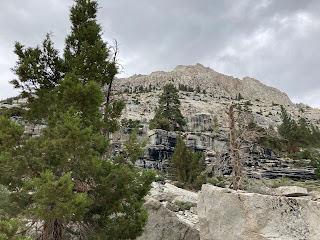
Perhaps not surprising given the ascent, the descent was not a great deal better:  treacherous rocks, big steps, sliding, and in parts the path was not very evident.  One of my great fears is losing the path, especially if I cannot see anyone else - or I am being trailed by others counting on me to find the right one.


Sadly, my records do not specifically record what we had for lunch in the meadow where we stopped.  My guess is it was something easy and quick, but (apparently) not very memorable.

Just after lunch came the rain.


Rain was listed as a potential outcome in the list, but not something I had experienced before.   Apparently the packing guide recommended bringing at least a plastic garbage bag to cover the pack, or a pack cover itself - and a rain jacket.  

Guess who had none of these things.


D The Guide intervened (probably, honestly, saving my life) by lending me a rain poncho/pack cover he had.  It was an extra large and I am small guy and the poncho draped down over me with the strings almost causing me to trip, but it worked.  I looked for all the world like a turtle on the march.


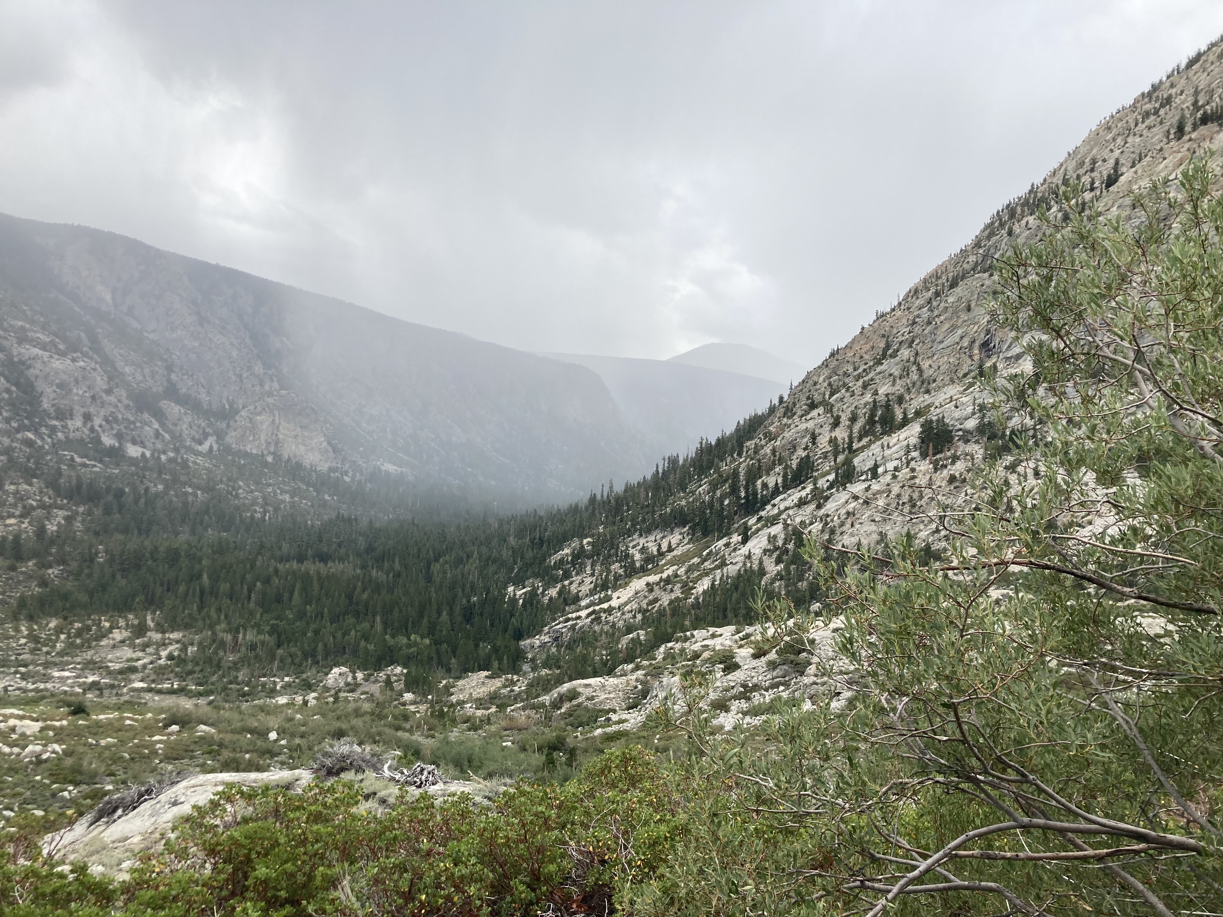
The latter part of this hike become one long, sort of wet nightmare.  The rain became that sort of drizzle that most of us know is best for reading books from living rooms and drinking tea, not marching through the wilderness.  On again and off again, drizzle and then none.  We slogged our way up and bit and back down, before hitting the last challenge of the day: Chocolate Ridge.


Chocolate Ridge (no pictures, it was raining) was a steep ascent of about 100 feet or so with steps at least 1.5 to 2 feet tall in places.  Add to it a drizzle and wind, and what was at best a challenging hike became a true challenge of weather and endurance and "I sure hope I do not blow over in this".


At the top of ridge, we started down - which was its own adventure.

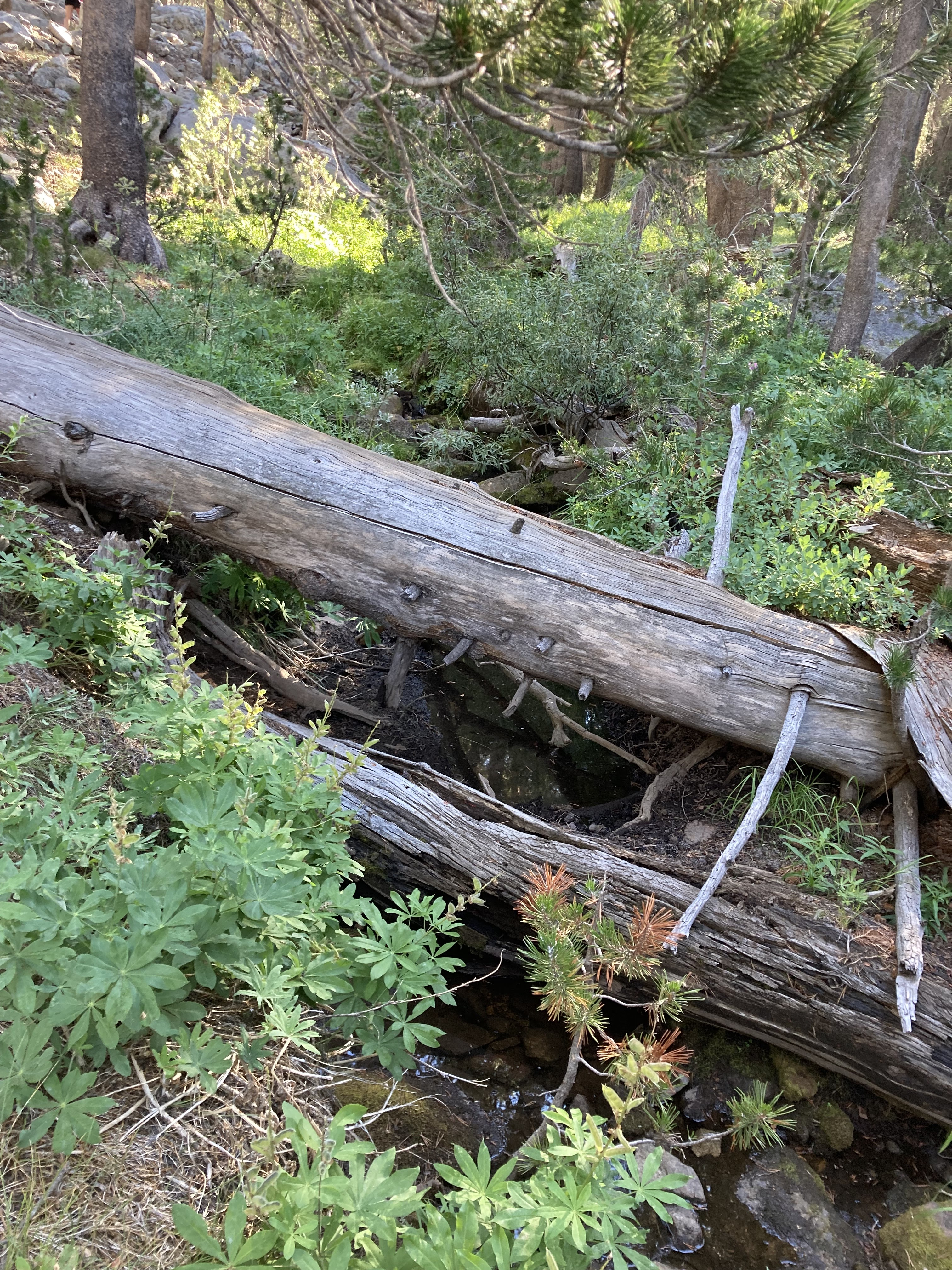
The path down largely followed a streambed (lots of these trails did; not a problem in Summer overall but probably quite problematic in Winter).  In this case the streambed went through brush, sometimes low and sometimes almost chest high to me - brush that had spent the previous hours getting soaked by a grey mantle of rain.


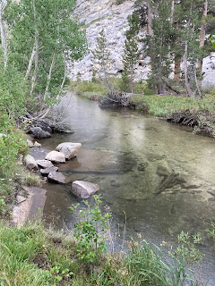
It was awful all the way around.  I was soaked, my pants were soaked, the thin material that constituted my poncho was soaked.  In some ways I was lucky:  those with backpack covers and rain jackets got the full force of the wet on their jackets and pants.  We were at least an hour in the dreary, misty trail of rain-tears and tearing brush before we bottomed out in the Kern Valley by the Kern River.


Our campsite for the evening, Junction Meadow, was only some 100's of feet (and three stream crossings) beyond our exit point.  The rain let up enough that we could set up in relatively dry conditions - everyone was carefully looking at the ground under trees for where they had blocked the rain.  We were all soaked and tired, but soon had some soup and a fire blazing away to warm us (and dry shoes).  

Dinner that night was soup - I have failed to mention it, but we had soup every night and it became a welcome first course - followed by broccoli beef with gravy and mashed potatoes - and tortillas.  We commiserated about the rain, watch the fire blazed - and then magically disappeared when the rain started falling again.


Never before have I heard rain on a tent at night.  It was a magical sound.

Tuesday, August 30, 2022

2022 Mt. Whitney Day 4A: Colby Lake to Junction Meadow - Colby Pass

 Distance: 10.96 Miles/17.64 Km

Time: 9.5 hours

Elevation Gain: 1665 ft/507.5 m


This morning, after a breakfast of granola and fixings, we packed up to head for our first truly challenging ascent:  Colby Pass, 12,000 feet/3567 m above sea level.  If you look in the picture below, just to the right of the trees on the left is a small dip.  That is what we were headed to.


The ascent quickly led us up past Colby Lake for one last view.


As we arrived at the based of the ascent to pass, one thing that quickly stuck out was that there was no clear path to the top.  Not to worry, assured our guides:  It is there as a series of switchbacks that can be ascended.


If there was a path there, it surely did not reveal itself to my eyes.


In hiking, of course, there are only two options:  go up or go back.  Going back was at least three days of hiking back to a trailhead with a van that was no longer there, so the only option was to go up.

This was hard climbing, some of the hardest that I have done. It was not that I felt like I was ever in any particular danger of falling off, just that due to the steepness of the pass it was pretty much directly up from switchback to switchback.  Adding 30 lbs of supplies and gear to your overall bodyweight just makes the issue that much more "invigorating".


Looking up is of no benefit either:  If one is lucky one sees nothing; if one is not, one sees the heads bobbing from the climbers ahead of you.  Somehow that makes it all the more depressing, seeing how far you have left to climb.


The trail never really "evened out":  It was always up and up and up and an angle.  My stops got more and more frequent; hauling myself forward with my hiking poles became more and more of a thing.  For such a relatively short distance, this was both physically and mentally challenging.


And then - after walking and stopping and looking back at the view and giving up on looking ahead because it is terribly depressing, one looks up - and suddenly, the top is in sight.

Never have I been happier.


I was midway to the top of the pass as I stumbled over.  We waited as the remaining members of our team pulled themselves over the top as well, then celebrated with water and a snack.

Colby Pass, as it turns out, mattered a great deal.


For myself, Colby Pass was the first truly significant hiking challenge I met on this hike - yes, there were ascents and descents, and yes, they were challenging - but Colby Pass was the first one that had me doubting whether or not I could complete this hike, let alone scale Mt. Whitney. Standing beneath the pass, looking up at what appeared to be a solid rockfall wall with no path and being told we are going up and over, was disheartening.  Actually realizing what the climb involved added nothing to my encouragement.

But I made it.  And later - several times on this hike, including ascending Mt. Whitney - when I felt that I simply could not go on, I reminded myself that I had climbed Colby Pass.

If I could climb Colby Pass, I could do anything.


Monday, August 29, 2022

2022 Mt. Whitney Day 3: Big Wet Meadow To Colby Lake

 Distance:  4.83 miles/7.8 km
Time:  5.5 hours
Elevation Gain:  1944 feet/592 m

Breakfast this morning was English Muffins and sausages as we packed up and prepared for a sort of intermezzo hike, a shorter hike between two locations which was just as much to a location as it was to continue with the journey. In this case we would be hiking up the Granite massif we saw yesterday (Whaleback Ridge) and up and around to Colby Lake, positioning us for a longer ascent and distance the following day.

After the initial skirting of Big Wet Meadow, we started ascending up Whaleback Ridge into what I consider High Sierra country.  We marched along the stream that fed Big Wet Meadow .

Below is Shorty's Cabin, an old trapper's cabin which is a landmark for the hike.  Apparently there are more than one around the Wildernesses from the days of trapping; this one is the best preserved.


We continued our ascent.  If you look in the picture below, the postage stamp sized green space is Big Wet Meadow.


For lunch that day, we stopped on a granite face with the stream flowing over it (lunch being peanut butter and jelly tortillas, which worked surprisingly well).  We spent an extra long time there, watching the water run.  Some soaked their feet; our guides slide down the rock into the pool (with the accompanying torn shorts in D's case).


After lunch, it was another round of ascending with stream crossings.  I had my first big stream crossing fail here:  the rock slipped out from under me and I sat down in the stream.  Fortunately The Outdoorsman was behind me and braced me so my pack did not go in and D the Guide was in front and grabbed me.  The only concern was my glasses, which slipped off my head and feel into the stream - right at D's feet!  We very carefully extracted the glasses and except for a slightly bent hiking pole (bent back into shape by The  Outdoorsman,), I was none the worse for wear.


One more round of ascent, then Colby Lake came into view.

Camping sites were a bit harder to come by here as there was much more granite exposed; we had to separate into almost three different camps.  It was higher off the water's edge as well, so access was not nearly as convenient.

Fortunately for me, there was a small stream nearby that made laundry day possible:


Dinner that night was fajitas, complete with tortillas, tomatoes, rice, refried beans, and fajita mix itself.  Fajitas was not something that I would have thought would work on the table but we separated everything into individual stations (I was the rice guy) and it worked surprisingly well.  One of our team also had a birthday which was ultimately celebrated with a small stack of chewy granola bars and some dysfunctional cotton swabs infused with petroleum jelly as a candle (which, sadly, did not work) - but was well received none the less.


Sunday, August 28, 2022

2022 Mt. Whitney Day 2: Ferguson Creek To Big Wet Meadow

 Distance:  9.41 miles/15.14 km

Time:  7.5 hours

Elevation Gain:  2027 ft/617.8 m

Waking up on this morning was painful.  My shoulders/back were aching from the mattress pad.  This would be come a regular contest each night as I worked to find the optimal positioning for sleep (I never found it).

Our breakfast this morning was oatmeal with craisins and brown sugar - one of the "camp" breakfasts I always love, and actually pretty similar to how I eat normally.  After packing up, we started uphill again for a "stiff climb" as our guide D said - in fairness, our guide often used a collection of unusual adjectives to describe what was essentially always uphill of some type or nature.  I came to mistrust his "descriptions" a bit over time.

Our hike was continued in record time, almost half of what was expected on the "list".

The "list" was a sheet kept by the guides as provided by the hiking company's founder in terms of what he expected the average time between rest stops to be.  It was a fascinating insight into how the hikes were organized and planned.  I never actually saw "the list" up close, but saw it referenced often.

Of note, we more often than not beat the times listed.

After our initial ascent, we marched for a while along The Roaring River, which ran loudly and wildly along our path.  The green water cleared over rocks and down granite faces, providing a pleasant backdrop for our hike in the morning.

Lunch on this day was charcuterie:  beef jerky, string cheese, almonds, and dried apricots.  This are my favorite sorts of hiking lunches (and probably, in real life as well):  finger foods, and salty ones at that.  The fact we have these lunches in the most amazing scenic beauty does nothing to ruin them either.

The hike, as we continued on, was through forests that I would usually associate with rivers at lower elevations as well; there was a noticeable humidity in the air.  After a short afternoon of hiking, we made one more ascent into Big Wet Meadow (below):

Big Wet Meadow is an Alpine Meadow, probably the biggest one I have ever seen.  The granite structure in the left hand side of the picture above is Whaleback Ridge (important as we will hike along side it and around it the following day).  The meadow comes with rugged mountains and a river running through it.


After arriving and setting up our tents, we had 3-4 hours of leisure before we had dinner.  Most everyone went down to the river; some to swim, some to wade (like me), and some to do laundry, which hung out on the trees and bushes.  The weather was neither too warm nor too cold, almost a pleasant sort of Spring Day which belied the hotter weather we had left behind.

It is both a relief and a pleasure to be somewhere like this when one has not a lot on the agenda to do.  I wandered back and forth between sitting at the river and my tent, spending a fair amount of time watching my fellow hikers enjoy their time here.  The mountains loomed over us; not so much threatening as protective of the meadow that ran between all of them.

Dinner tonight was beef stroganoff - as with all of the meals, delicious (to be fair, dirt might have been delicious every day after hiking).  Dessert was Vanilla wafers, something I have not had in years.  The cookies, although beaten up a bit by transport, were none the less delicious.

The sunset as it dropped below the peak was beautiful.


Saturday, August 27, 2022

2022 Mt. Whitney Day 1: Jennie Meadows to Ferguson Creek

Mileage:  11.1 miles/17.86 km
Elevation Gain:  1586 ft./483 m
Time:  ~ 9 hours

The call to breakfast was early on our first morning, allowing for individuals to get used to the idea of getting up, getting breakfast, and packing up.  I was up early with The Outdoorsman - I am always unable to sleep well when I hike, be it because of the relative light of moon and dawn, the discomfort of a mattress that never quite seems comfortable, or just because I do not sleep well at night, or perhaps a combination of all three).  We ate our breakfast of bagels, cream cheese, bananas, and coffee as others stirred and slowly got up.

The Outdoorsman and I were two of the first to have our tents down and packs up first - a practice we have picked up from our own training hikes, he by practice and I by his training.  We are always ready to go early, so we waited as others came to get breakfast and then packed up their own tents and gear.


One of the addition to our packs was a bear can, about a 2 foot high, 1 foot in diameter plastic cylinder which is bear resistant and which has our food for the next 8 days.  Each of us would carry one in our pack over the next 7 days.  They started out rather heavy, but grew lighter over time as food was eaten and weight was redistributed.

After finishing breakfast and packing up, the van was locked (to be picked up later by other team members to meet us at the end).  At that point, there as no choice:  we had to go forward.

The hike started with a climb of about 45 minutes or slow, a bit of an uphill grade.  It was not too stiff of a climb, but a good leg stretcher and an idea of what we would begin to see as we continued on our trail.  The sky was blue, and the sun bright but not oppressively hot (the change in temperature was a welcome break from the heat of Summer).  We continued up to a pass through granite and pine, similar to what The Outdoorsman and I had experienced in our own hikes, then a slight descent to our lunch spot (below):


Lunch was a tortilla filled with Asian Slaw and cut up fried chicken (marvelous things tortillas; good for any number of camping meals and packing much more flat than bread).  We sat and ate and marveled at the view.


The afternoon was largely spent in a descent to our camping spot that evening.  This descent was on a trail that involved a lot of dirt and sand on the trail - besides being much warmer (with the sand reflecting the sun up), it pointed out one big gap in my hiking footwear:  mesh shoes, while good for many things, are not very good at all for keeping things like sand and dirt out.  My feet began to feel gritty immediately, which would be a refrain that followed me for the rest of the hike.


By later afternoon we continued to drop until about 4 PM or so we arrived at our campsite for the night, Ferguson Creek. We all began what would become a standard practice at every trail's end:  Our guides would start by getting water ready for filtering and use, and we would spread out, looking for campsites, after which the assembly of the tent and arrangement of gear would take place.  I would become more proficient at this as time went on, getting to site readiness within 15 or 20 minutes.


The Creek was wonderful:  cold and clear.  In a first on this trip, I had purchased a pair of camp shoes (generally sandals, "Crocs", or secondary shoes that one wears in camp to give one's feet a break from the hiking shoes) - in this case a pair of plastic sandals.  I put my feet in the creek - amazing!  It was such a relief to be able to scrub the dirt from them and just let them rest in the water for a time.

(In a now-amusing subplot, I took off my glasses to wash my face and placed them on the rock beside me.  I failed to realize that I had left them there until about 20 minutes later when I went to look at pictures on my phone and could not really focus.  There were a few minutes of panic until I retraced my steps and there they were, right where I had left them.)


We were able to have a fire for the evening (fires were allowed below 10,500 ft.), and so ate our Chicken Noodle Soup and Pesto Pasta around the fire.  I do not know why food tastes better when one hikes, but it certainly seems to.  We watched the fire, tentatively exploring each other a little more.

At the close to the evening, we have to list "Roses and Thorns" - things that went well and things that perhaps did not.  I, of course, simply list that today, I did not die.

The creek made a wonderful backdrop of white noise as we drifted off to sleep.